Agricultural (Farm) Credit

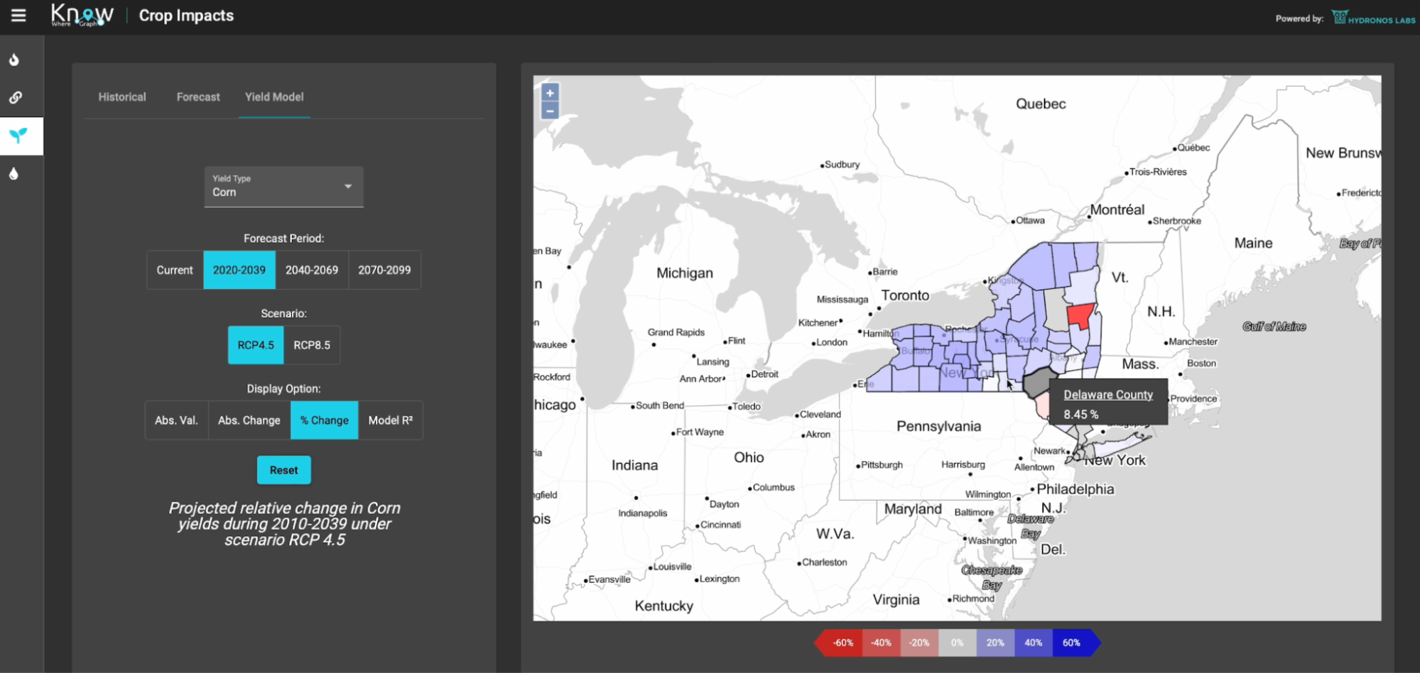
Agricultural (Farm) Credit risk assessment and land valuation is an activity essential to the 70 farm credit associations and four banks in the U.S. that annually provide more than $2 billion USD in farm loans. Together with our partners, we have developed a use case focused on enhancing the quality and speed of evaluations of the key credit factors in the farming operations collateral valuation process to estimate the level of risk associated with a particular loan application. Five key factors include: (1) appraisals to calibrate the system, (2) loss given default (i.e., how much can be recovered upon default), (3) prepayment (i.e., forecast to deal with cash flow and tax laws), (4) crop yield projections, and (5) modeling for probability of default. This assessment must consider a multitude of different data, such as the specific farm equipment and farming practices used, local weather conditions, prospective crop type, and predicted crop prices. We first focused on graph-based assessment of current and future land value, wherein agricultural operations that employ soil-health farming practices experience less financial risk than conventional operations. Farming operations using these practices can be identified, mapped, and quantified using remote surveillance and data analysis, and lifted to the KnowWhereGraph. While most of the data and services are part of a bespoke solution, all data about soil health, soil management practices, and crops (e.g., vector data sources such as the Soil Survey Geographic database SSURGO and raster data sources like the USDA's Cropland Data Layer) have become part of the public graph, accessible to a multitude of other applications.